Hiking at Shenandoah National Park, VA
Hiking the Hawksbill Mountain
What to bring/wear
Schedule
Shenandoah National Park Map
- When:
CANCELLED for 10/19/2024 - Where: Shenandoah National Park (
Main Website |
Map Website
)
North Entrance: ( Driving Direction )
17157 Skyline Dr
Front Royal, VA 22630
- Fee: Children under 16 are free
Standard Pass: (1 vehicle with all passengers for 7 consecutive days): $30
Annual Pass: (pass holder + 3 adults in the same vehicle for a year): $55
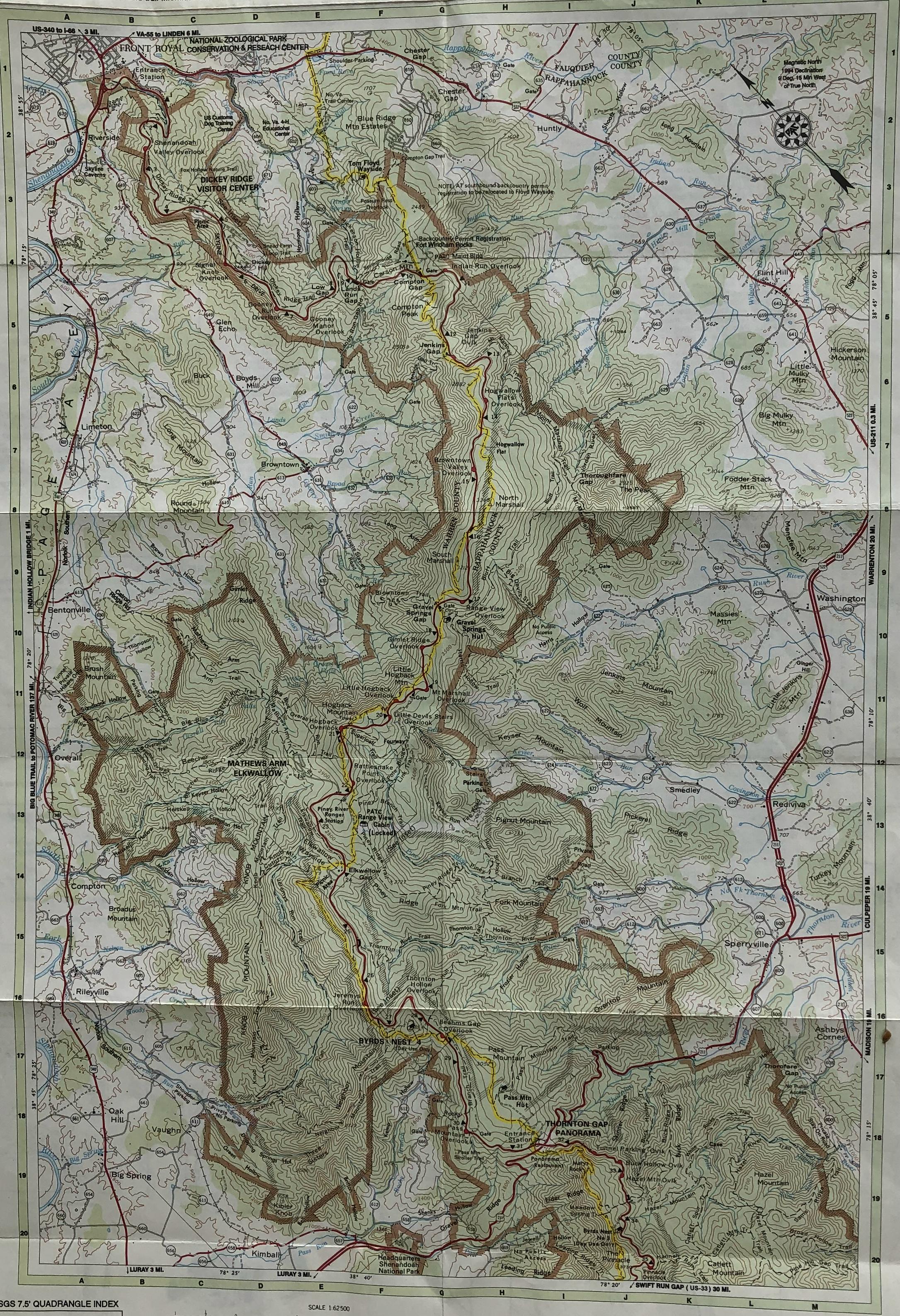
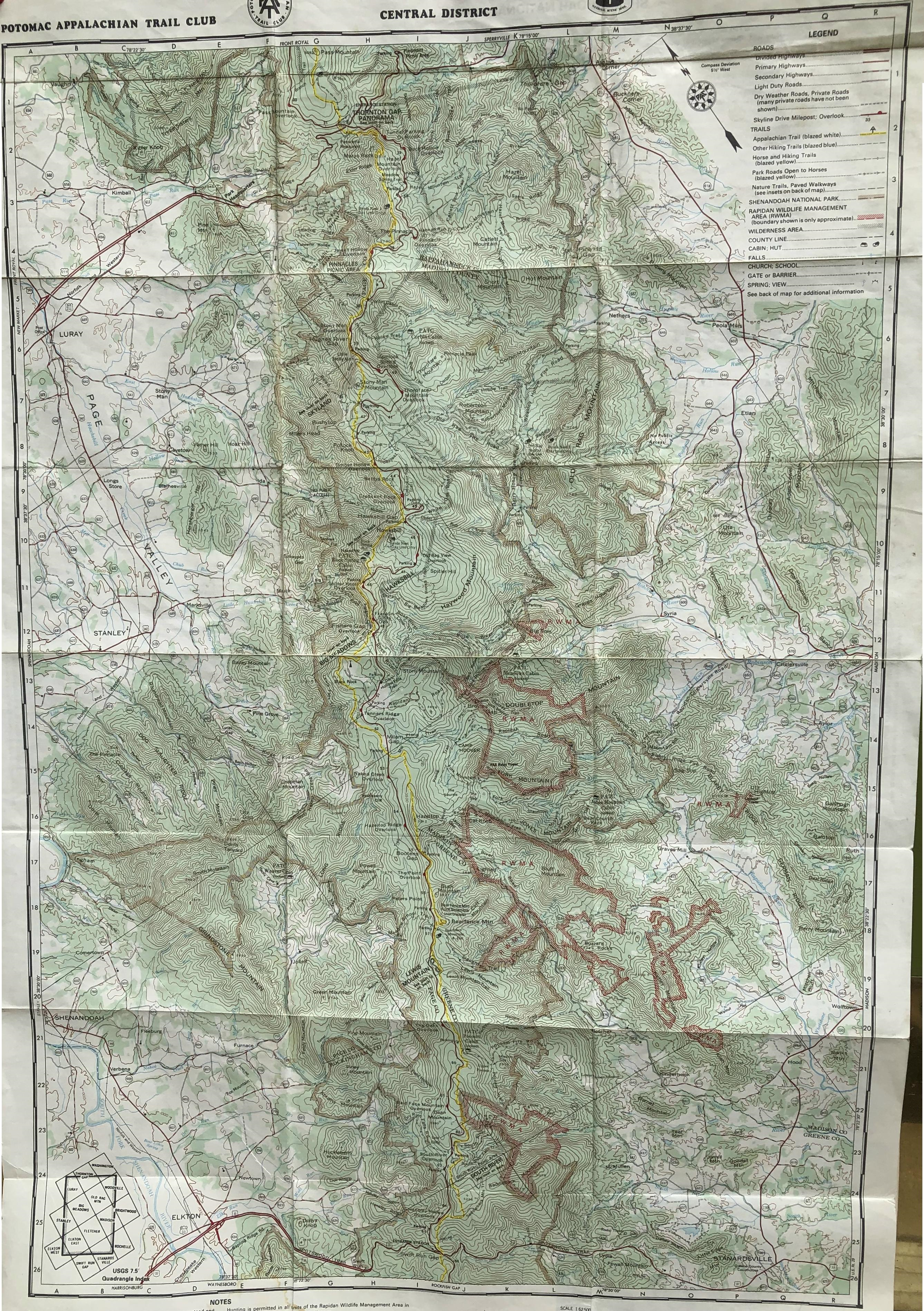
- Official maps:
1. Current map |
2. Previous Map (pre-2013, easier to read) |
- Maps to be used to identify Point of Interest during our trip.
1. North District
2. Central District
Hiking the Hawksbill Mountain
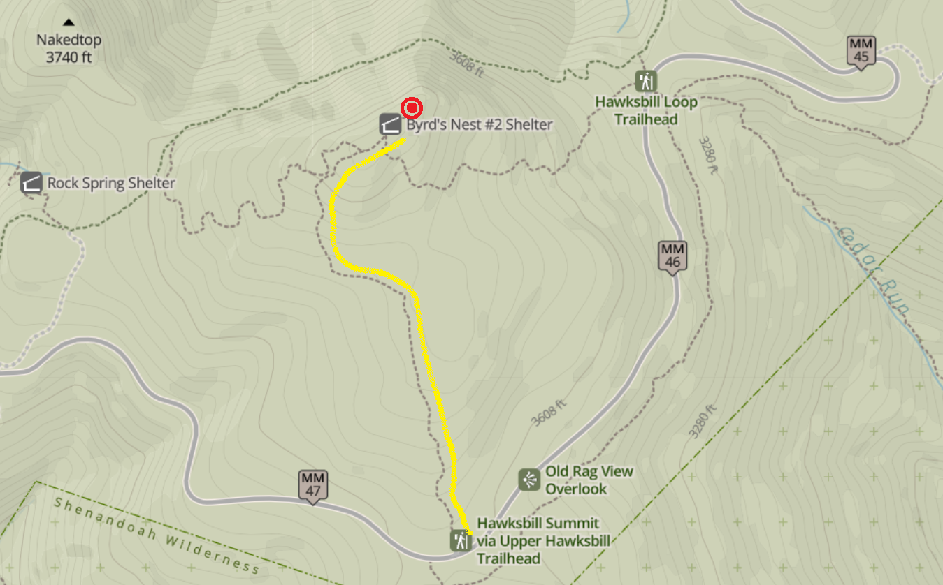
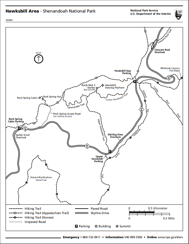
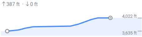
- Hawksbill Mountain stands at 4,051 feet, and is the highest peak in Shenandoah National Park.
- From the Upper Hawksbill Parking Lot, take the gravely-dirt Upper Hawksbill Trail to the summit.
This trail is void of big rocks and is reasonably wide for 2 people to hike side by side. It also provides space for hikers to pass each other easily. - The first .3 mile is a gradual uphill, followed by .3 mile of relatively flat and a slight downhill.
At .65 miles, the trails turns 90 degrees to the right and the trail incline becomes steep and remains so until the tops. - Prior to the summit, the path passes 2 mile markers.
The first is on the left, mile .85, marking the Salamander Trail.
The second is on the right, at the 1 mile mark. It is at this point the Lower Hawksbill Trail merges into the Upper Hawksbill Trail. - Walk past the Byrds Nest 2 Shelter and turn right at the top.
Pass the opening of the shelter and follow the path sign to the viewing platform. - Return to the parking area via the same route.
See trail map and planned route at bottom of page
What to bring/wear
- Hiking shoes or shoes with good traction.
- Hiking stick/pole
- Hat
- Water
- Pack your lunch (to eat at the Summit during our hike)
- Compass
- Raincoat
- Jacket/Hoodies
Schedule
Shenandoah National Park Map
North District (Mile Marker 0 - 35)
Central District (Mile Marker 29 - 66)
Hawksbill Area Trails
Upper Hawksbill Trail Route
